After
saying good-bye to MT at Pensión Girasol,
Don went to Praza de Obradoiro to
start for Muxía. He had studied detailed instructions, from the CSJ web site
for leaving Santiago, but yellow arrows spray-painted on the sidewalk or street
clearly led the way. There was a lot of climbing; most of the way was on paved
roads. All other walkers were passing Don, who had sore thigh in the morning
and a sore tailbone by afternoon. So he soon decided that it would be a good
idea to send his backpack ahead for the next 2 days and try to do the 30+ km a
day without the pack.

Santiago to Negreira Map (caminodesantiago.consumer.es).

9:55 AM – Santiago – ramp down to the W from
Parador Hospital de los Reyes Católicos; chains on front of parador terrace on
right; Igrexa de San Fructuoso down to left.

9:55 AM – Santiago – yellow arrow (see red
circle) spray-painted on pavement of ramp of Rúa Costa del Cristo down to the W
from Parador Hospital de los Reyes Católicos; chains on front of parador
terrace on right; Igrexa de San Fructuoso down to left.

9:56 AM – Santiago: Restaurante dos Reís
under parador terrace on Rúa Costa del Cristo ramp down to W of parador (this
is where pilgrims are told to go and wait, by the carriage, for the free
pilgrim meal, as we did last year).
At
10:08, Don arrived at the Carballeira de
San Lorenzo, a small, shady park with a lot of old oak trees.

10:08 AM – Santiago: first real Camino signs
at park.

2479
Thursday, September 25, 2014, 1008 AM – Santiago: first real Camino signs
(with yellow arrows) at park (telephoto, 54 mm)
The
first few stone markers had the distance to 3 decimal points (Spain uses comma
for decimal point), probably to Finisterre since the first 2 stages were the
same (he never saw markers with distances to both Finisterre and Muxía, as the
guidebook said).

10:10 AM – Santiago: “88,022 KM” Camino
marker stone.

10:11 AM – Santiago: after park, fork in
road with no (easily) visible signs or arrows.

10:11 AM – Santiago: after park, fork in
road (only when viewing this photo on computer screen did Don see the tiny
arrow on utility pole to right of gate [see red circle]).

10:11 AM – Santiago: official Camino marker
on utility pole was visible only after turning left at that fork in road.

10:12 AM – After Santiago: Don’s single
shadow on the road (no MT) – long legs in early morning sun.
Around
10:14, Don came to the stone bridge over Río Sarela in the hamlet of Ponte Sarela (pop ?).

10:14 AM – Ponte Sarela – stone bridge (with
yellow arrow on rail).

10:16 AM – After Ponte Sarela – Camino sign
and marker stone on smaller road.
Very soon, the Camino route was
in the countryside. The rapid exit from the city is a stark contract to the
arrival in the city from the east. You walk uphill on a trail lined with
foxgloves, ferns, and blackberries, turning around for great views of Santiago
behind you.

10:17 AM – After Ponte Sarela – tree-covered
path.

10:18 AM – After Ponte Sarela: fork in wooded
path with no visible yellow arrow.

10:18 AM – After Ponte Sarela: fork in wooded
path with no visible yellow arrow; but on the leaning tree in center there was
some red paint (see red circle).

10:19 AM – After Ponte Sarela: the yellow patch
at the top may be a poor arrow; the red arrow points left (where the Camino
actually went); the red “R” is for “ruta” (route), some other route that
happened to coincide with the Camino.
Around
10:30, around the “86,963 KM” Camino marker stone, Don reached the place at the
top of a hill where the CSJ notes said to look for a good view back to the
Santiago Cathedral on a clear day.

10:32 AM – After Ponte Sarela: another
Camino sign and “86,963 KM” marker stone.

10:33 AM – After Ponte Sarela: “86,963 KM”
marker stone.
About
half an hour after leaving Santiago, the path through the woods ascends to join
a small asphalt road that leads to Sarela
do Baixo. From there, there is a lovely view back to the Santiago
cathedral.

10:29 AM – After Ponte Sarela: first view of
Santiago back to the E; could barely make out the Cathedral in the morning fog.

10:34 AM – After Ponte Sarela: slightly
better view of Santiago back to the E, through break in trees; but could barely
make out the Cathedral in the morning fog.

10:35 AM – After Ponte Sarela: view back to
Santiago Cathedral in morning fog (telephoto, 260 mm).
Don
continued along wooded paths.

10:38 AM – After Ponte Sarela: more wooded
path.

10:54 AM – After Ponte Sarela: yellow arrow and red (R = ruta) arrow indicating right turn; “85,386 KM” marker post and
Camino sign on other side of road.

10:55 AM – After Ponte Sarela: “85,386 KM”
marker post.
Around
11:07, Don reached the village of Piñeiro
(pop ?), where the CSJ notes said to turn right, in front of a modern hórreo.
After being in the open
countryside for about 1 km, the path enters Piñeiro, where traditional architecture is overwhelmed by big,
modern houses as Santiago’s commuter belt stretches westward.

11:07 AM – Piñeiro: Camino sign (by bus
stop) and modern hórreo.

11:07 AM – Piñeiro: modern hórreo - the
first one on this side of Santiago, and a long one with 4 pairs of legs
(telephoto, 90 mm).
Leaving Piñeiro on a narrow
asphalt road, there is a lovely pastoral scene, with great views of meadows,
stone houses, and hórreos.
Around
12:20, Don came to the next village (possibly Carballal).

11:21 AM – Next town (Carballal?): view of
town the Camino did not enter.

11:25 AM – After (Carballal?): rocky path
through eucalyptus.

11:37 AM – After (Carballal?): path through
eucalyptus.
Around
11:45, Don arrived in next village (possibly Quintáns).

11:44 AM – Next town (Quintáns?):
intersection (hard to see any arrow).

11:44 AM – Next town (Quintáns?):
intersection with hard-to-see yellow arrow (see red circle).

11:44 AM – Next town (Quintáns?): yellow
arrow on side of Camino marker post.

11:47 AM – Next town (Quintáns?): yellow
arrow on utility pole.

11:48 AM – Next town (Quintáns?): Camino
sign and “82,062 KM” marker post.

11:49 AM – Next town (Quintáns?): cruceiro
in yard of private house (crucifixion at top).

11:49 AM – Next town (Quintáns?): back side
of same cruceiro (Virgin at top).

11:50 AM – Next town (Quintáns?): old wooden
hórreo.

11:51 AM – Next town (Quintáns?): other side
of same hórreo.

11:50 AM – Next town (Quintáns?): another
hórreo across the street.

11:52 AM – Next town (Quintáns?): another
(partly) modern hórreo, with crosses.

11:56 AM – After that town (Quintáns?): tall
[collard greens?] plants and cornfield.
Around
12:10, Don came to the village (possibly Roxos).

12:09 PM – Near (Roxos?): approaching town.

12:11 PM – Near (Roxos?): Camino sign and
marker post at intersection; another sign hanging on utility post.

12:11 PM – Near Ventosa: sign hanging on
utility post for “Bar O Cruceiro 2.5 km Bocadillos [sandwiches] Aguapesada” [sic!, actually Augapesada](where I ended up eating lunch).
Around
12:19, Don arrived at Alto do Vento
(Bar).
By
this point, the Camino had left the Concello de Santiago and entered the Concello de Ames.

12:19 PM – Alto do Vento: Restaurante Alto do
Vento – Casa de Xantar; with Camino sign and marker stone out front.

12:21 PM – Alto do Vento: utility pole with
yellow arrow pointing right and red (ruta) arrow pointing left.
Around
12:28, Don arrived at Ventosa (pop
?).

12:28 PM – Ventosa: bus stop shaped like
hórreo with “Concello de Ames.”

12:34 PM – Ventosa: cruceiro and hórrreo
(with matching crosses).

12:36 PM – Ventosa: two hórreos on street.

12:36 PM – Ventosa: two hórreos on street
(close up).

12:37 PM – Ventosa: 2nd of those two hórreos
on street (with Celtic cross).

12:38 PM – Ventosa: a 3rd hórreo on street.

12:40 PM – Ventosa: large electric pole by
fork in path.

12:40 PM – Ventosa: large electric pole by
fork in path; look close for yellow arrow (see red circle).

12:41 PM – Ventosa: yellow arrow at base of
electric pole, pointing right.
Around
12:47, Don reached Lombao (pop ?).

12:47 PM – Lombao: albergue ads.

12:47 PM – Lombao: ad for Parradilla O
Cruceiro in Aguapesada [sic! actually Augapesada](where Don would eat lunch).
At
12:52, Don arrived in Castelo (pop
?).

12:52 PM – Castelo: yellow arrow, Castelo
city limit sign and signs for Parroquia de Ames and Concello de Ames, entering
town.
Don
stopped 1:00-1:30 in Augapesada (pop
126), which was half-way to Negreira.
Augapesada is a village of
pretty stone houses with small square windows.
He
stopped at Bar Cruceiro for baño and
lunch: ordered pincho de tortilla (warm, with potatoes and red peppers) which
was served with bread and 2 plums; can of Coke (total 4.60€). He got sello:
“Parrillada Cruceiro.” After lunch, he stopped at a farmácia nearby for a tube of antibiotic cream (1.90€) for a scrape
on his right calf.

12:56 PM – Near Augapesada: another sign for
“Bar O Cruceiro” in "Aguapesada" [sic! actually Augapesada] (just 300 m).

12:57 PM – Augapesada: city limit sign.

12:59 PM – Augapesada: Parrillada O Cruceiro
exterior.

12:59 PM – Augapesada: Parrillada O Cruceiro
exterior – close-up of sign and terraza.

1:07 PM – Augapesada: Don’s freshly-stamped
credencial; bread; pincho de tortilla (with potatoes and red peppers) and salad.

1:08 PM – Augapesada: the owner then brought
2 plums (gratis).

1:32 PM – Augapesada: Parrillada O Cruceiro
exterior, when leaving.

1:36 PM – Augapesada: Farmácia nextdoor to
Parrillada O Cruceiro, when leaving town.

1:39 PM – Augapesada: another bus stop
shaped like hórreo “Concello de Ames.”

1:41 PM – Augapesada: medieval bridge
(recently restored) over el Rego dos Pasos.
Leaving Augapesada, there is a very steep climb to Carballo,
scenically set among fields and trees and dotted with the region’s traditional
red-roofed stone houses,
Don
continued, mostly on forest paths, along which there were a series of 6
concrete benches for pilgrims to rest. Many of these are adorned with words of
“ánimo,” encouraging the walker to complete the climb the sometimes very steep
woodland path to the Alto do Mar de
Ovellas.

1:49 PM – After Augapesada: sign for Turismo
Rural O Folgo with “free transport from Negreira and surroundings.”

1:51 PM – After Augapesada: path through more
eucalyptus.

2:09 PM – After Augapesada: 3rd concrete
bench with graffiti: “Animo” [courage]. “You can do it,” and “”Vi___ a vivere.”

2:28 PM – After Augapesada: fountain (not
potable) with hiking boot on top.
At
2:33, Don came to Carballo (pop ?).

2:33 PM – Carballo: entering town, with city
limit sign.

2:36 PM – Carballo: hórreo with cross.

2:37 PM – Carballo: vineyard with hórreo at
far end.

2:37 PM – Carballo: hórreo at far end of
vineyard (telephoto, 260 mm).
At
2:49, Don reached Trasmonte (pop ?).
Don never did find the Baroque church of Santa María (mentioned in CSJ notes),
but did find the cruceiro.

2:49 PM – Trasmonte: city limit sign, before
the town.

2:54 PM – Trasmonte: “74,052 KM” marker
post.

2:55 PM – Trasmonte: cruceiro, a few meters
off the Camino (when Don was looking for the Baroque church, which he never
found).

2:57 PM – Trasmonte: cabbage patch (it
smelled like cabbage).
Around
3:03, Don reached Reino (pop ?).
Reino and Burgueiros are both
wealthy hamlets with lots of big new houses.

3:03 PM – Reino: city limit sign.

3:03 PM – Reino: fallen along the path were
a lot of those prickly green balls we had seen growing on trees earlier.

3:06 PM – Reino: most of the prickly green
balls here were broken open (by the fall or by creatures) and were either empty
or had nuts inside, which turned out to be chestnuts (castañas).
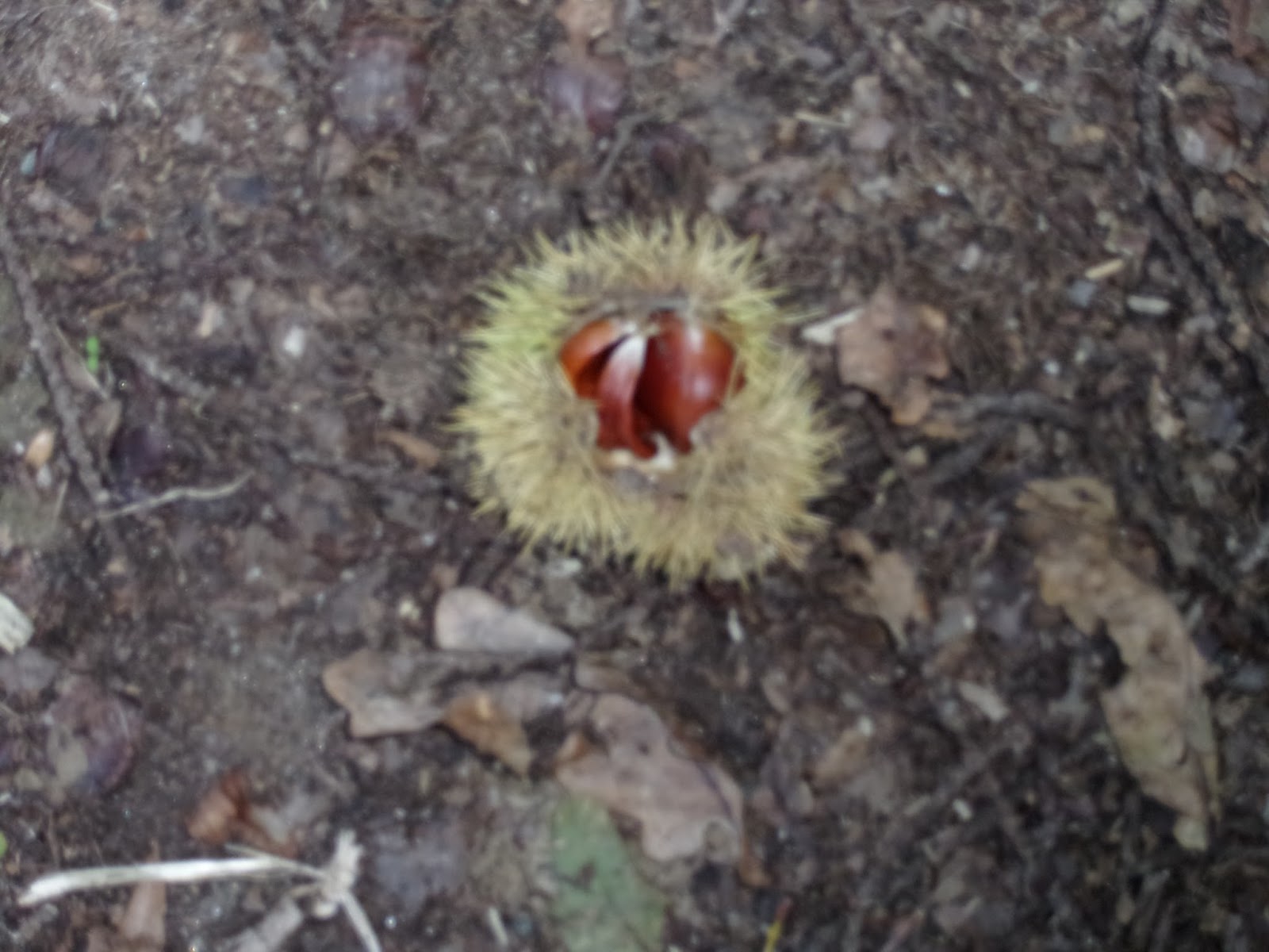
3:06 PM – Reino: another opened chestnut.

3:07 PM – Reino: chestnut in Don’s hand.

3:13 PM – Reino: tree with green prickly
chestnuts.

3:15 PM – Reino: green prickly chestnuts in
tree (close up).

3:16 PM – Reino: tall green [collard] plants
(smelled like cauliflower).
Next, around 3:24, Don came to Burgueiros (pop ?). This is where Don
got out the soft blue cloth to cushion his tailbone again.

3:24 PM – Burgueiros: city limit sign.

3:27 PM – Burgueiros: another chestnut tree
with green prickly fruit (some of which were open to reveal nuts).

3:28 PM – Burgueiros: hórreo (with cross)
and flowerpots.

3:31 PM – Burgueiros: sun dial on old stone
building.

3:31 PM – Burgueiros: close-up of sun dial
(telephoto, 186 mm).
At
3:35, Don arrived at Ponte Maceira
(pop ?).
Ponte
Maceira
is a picturesque village idyllically set in a gorgeous green valley next to the
wide Río Tambre. It is a village of two parts divided by a stone bridge, Ponte
Vella (aka Ponte Maceira), with 5 main arches leading up to a point, over the
Río Tambre. The bridge has Roman origins, although it was reformed in the
Middle Ages (late 14th century), further reconstructed in the late 15th/early 16th
century, and restored in medieval style in the 18th century. There
are the 18th-century Capilla de San Blas (aka San Brais) and a large neo-medieval pazo (palace) del Baladrón (a grand
Galician country house built 1945-1955) on the far side of the bridge and
several stone houses with coats of arms.
The Negreira region and Ponte
Maceira appear in legends of St. James. The disciples who brought the body of
St. James to Galicia had to overcome many difficulties. One was asking the
permission of the Roman governor in Ruio (Finisterre), who had them locked in
prison. Managing to escape with the help of an angel, they made their way to
Santiago, pursued by Roman soldiers. When they reached Ponte Maceira on the Río
Tambre, the bridge collapsed, saving the disciples.
Ponte
Maceira was worth the whole day’s walk. (Don spent 40 minutes here.) The Río
Tambre is the division point between Concello de Ames and Concello de Negreira.

3:35 PM – Ponte Maceira: city limit sign “A
Ponte Maceira” and Camino marker post.

3:38 PM – Ponte Maceira: post with ads,
including Hotel Tamara “special pilgrims” in Negreira.

3:39 PM – Ponte Maceira: open prickly green
pod with chestnuts.

3:43 PM – Ponte Maceira: large (4-part) hórreo
with cross.

3:45 PM – Ponte Maceira: approaching
medieval bridge.

3:45 PM – Ponte Maceira: waterfall by old
mill.

3:46 PM – Ponte Maceira: bridge from near
side.

3:46 PM – Ponte Maceira: looking across
bridge from near side (horizontal).

3:47 PM – Ponte Maceira: looking across
bridge from near side (vertical); at far end of bridge is bell gable of Capilla de San Blas, and round building behind it to left is probably a palomar (dovecote).

3:47 PM – Ponte Maceira: pazo, above old
mill, and waterfall (view from bridge).

3:49 PM – Ponte Maceira: neo-medieval pazo
with formal garden; old mill below.

3:48 PM – Ponte Maceira: neo-medieval pazo
above old mill.

3:48 PM – Ponte Maceira: old mill on water.

3:49 PM – Ponte Maceira: view over bridge to Capilla de San Blas; round building behind it to left is probably a palomar (dovecote).

3:50 PM – Ponte Maceira: Capilla de San
Blas.

3:49 PM – Ponte Maceira: view downstream from
bridge; round building behind wall is a palomar (dovecote).

3:50 PM – Ponte Maceira: view toward old
mill and waterfall from far end of bridge.

3:51 PM – Ponte Maceira: view inside open
door of old mill.

3:52 PM – Ponte Maceira: view of upstream
side of bridge from path to mill.

3:53 PM – Ponte Maceira: downstream side of
bridge, from far side.

3:54 PM – Ponte Maceira: view of downstream
side of bridge from farther down road into town.

3:56 PM – Ponte Maceira: old stone building
with coat of arms.

3:57 PM – Ponte Maceira: cruceiro with Mary
(left) and crucifixion (right).

3:58 PM – Ponte Maceira: cruceiro side with
Mary.

3:58 PM – Ponte Maceira: side view of
cruceiro (close up).

3:59 PM – Ponte Maceira: cruceiro side with
crucifixion.

4:15 PM – After Ponte Maceira: another sign
for Hotel Tamara in Negreira – “menu and housing, special to pilgrims” only 2
km.
At
4:28, Don reached Barca (pop ?).

4:28 PM – Barca: city limit sign.

4:36 PM – After Barca: albergue signs
(including the following).

4:36 PM – After Barca: sign for “Albergue
Turistico El Carmen y Hostal Pension la Mezquita (2-star), with menú del
peregrino.
At
4:48, Don reached Chancela (pop ?).

4:48 PM – Chancela: city limit sign,
eucalyptus trees.

4:55 PM – Chancela: short round tower (like
ones seen in Ponte Maceira), probably not a watchtower, as Don had originally
thought; perhaps for storage. However, it was more likely a palomar (dovecote).
Around
5 pm, Don finally arrived in Negreira
(pop 6.700).
Negreira is the capital
of the comarca (region) of A Barcala. It is a modern town with decadent pastry
shops and good seafood restaurants. It is the largest town along the way to the
coast, but without great cultural or historical significance.
The ancient Nicaria Tamara appears in some legends of the Camino de Santiago. The
disciples who brought the body of St. James to Galicia had to overcome many
difficulties. One was asking the permission of the Roman governor in Ruio
(Finisterre), who had them locked in prison. Managing to escape with the help
of an angel, they made their way to Santiago, pursued by Roman soldiers. When
they reached Ponte Maceira on the Río Tambre, the bridge collapsed, saving the
disciples. This fact is reflected in the coat of arms of the Ayuntamiento (city
hall) and of Concello de Negreira. Nicaria Tamara was a stopping point on the
Romans’ Per Loca Marítima, linking Caldas de Reis with Brandomil, where silver
mines existed. In 876, Alfonso El Magno (the Great) gave Negreira to the see of
Compostela. In 979, Norman pirates ravaged the population. Later, in 997, the
Cordoban Muslims led by Almanzor attacked Santiago de Compostela. Negreira was
rebuilt by the King of Galicia Alfonso VII in 1113, continuing under the power
of Compostela. It was not until the 15th century that the Catholic Monarchs
Ferdinand and Isabella declared it a Royal villa; therefore, a royal crown
appears in the town’s coat of arms. Later, the Crown no longer had jurisdiction
over these lands, which were divided between the Archdiocese of Santiago and
the Count of Altamira.

5:02 PM – Negreira: welcome sign:
“Benvidos Concello de Negreira.”

5:02 PM (cropped) – Negreira: welcome sign:
“Benvidos Concello de Negreira” with coat of arms showing collapse of Ponte
Maceira bridge.

Negreira: coat of arms of Concello de Negreira,
showing collapse of Ponte Maceira bridge (es.wikipedia.org).

5:04 PM – Negreira: Santiago Peregrino
statue in median strip of large street (just before turning right toward Muxía).

5:05 PM – Negreira: statue of Minerva and
the bulls, on same median strip.
Along
the way, Don had seen signs for a special pilgrim rate at Hotel Tamara in
Negreira (which CSJ notes said had special pilgrim rate of 25€ for a single
room) and for another place with free transport to Negreira; so he decided to
stop first at El Carmen or Tamara, whichever came first, and try the transport
place if neither of those worked out. He found El Carmen first. The receptionist (Antonio) said they had places
available in the Albergue for 10€, but Don had seen that there was also a Pensión La Mezquita in the same
building and found they still had one single room for 25€ with a bathroom down
the hall (for his use only, with key). So Don chickened out on his first chance
to really stay in an albergue and took the single room instead. Antonio called
Casa Loncho in Olveiroa for him; they had
no more single rooms but only one double room with bath for 40€, Since the
2nd option on Don’s lodging list for Olveiroa was 40€ for a single room, he
took the double. That way, he could send his backpack ahead the next 2 days to Olveiroa
and Muxía. He tried to pay Antonio for the transport, but was told he would pay
at Casa Loncho (5€) because they were the ones who operated the transport
service, all the way to Muxía. Antonio just gave Don a tag to put on the bag.
For Muxía, Don had him write A de Lolo, since the first choice on our lodging
list had been A de Lolo – Hotel de Encanto. Don got sello: “Hostal-Restaurante
‘La Mezquita’.”

5:08 PM – Negreira: Albergue El Carmen and
Hostal-Pensión La Mezquita on corner, with restaurant on ground floor.

5:17 PM – Negreira: Hostal-Pensión La
Mezquita – Don’s room No. 1 on “3rd” floor).

5:18 PM – Negreira: Hostal-Pensión La
Mezquita – Don’s room No. 1 on “3rd” floor.

5:18 PM – Negreira: Hostal-Pensión La
Mezquita – hallway outside room No, 1; bathroom around corner to right.

5:18 PM – Negreira: Hostal-Pensión La
Mezquita – hallway and bathroom door around corner to right.
Around
7 pm, Don went down to check on the in-house restaurant, but there was no one
there. So he went out to look around the town. At a frutería (fruit store) near the albergue, he bought 2 small bananas
and one large “Red Chief” apple for 1.06€.

7:10 PM – Negreira: Rúa do Carmen sign
across the street from the albergue.

7:19 PM – Negreira: avellanos (hazelnuts) in
frutería (where Don bought fruit).
To the west, on the Praza do Cotón, he found the Pazo de Cotón.
The 14th-century Pazo de Cotón is a medieval fortress restored in the 17th century. It includes what must have been the original settlement’s arched and fortified gateway. Its stone gallery, across the town’s main street, has triple battlemented arches, balustrades, and miradors; the robust cylindrical towers (18th and 19th century) at the corners, which make its military past evident; and twelve stone coats of arms. The stone gallery and arch join the pazo structure with the Capilla de San Mauro [Chapel of San Mauro] (also known today as Capilla do Cotón), constructed in the 18th century.

7:28 PM – Negreira: - Pazo do Cotón – view
from outside the wall, through the gate, into the town.

7:28 PM – Negreira: Capilla de San Mauro and left
part of Pazo do Cotón (from outside the wall).

7:29 PM – Negreira: Capilla de San Mauro and
part of Pazo do Cotón (different angle, with more of the arches, from outside
the wall).

7:29 PM – Negreira: side and belfry of San
Mauro chapel.

7:30 PM – Negreira: side and back of belfry
of San Mauro chapel.

7:30 PM – Negreira: front door of “Capilla del
Carmen y San Mauro.”

7:31 PM – Negreira: view of portals from
front of San Mauro chapel.

7:32 PM – Negreira: right part of Pazo do
Cotón with cylindrical tower on corner (from outside wall).

7:32 PM – Negreira: view from right corner
back to gate and San Mauro chapel (from outside wall).

7:33 PM – Negreira: view through portals
into town.

7:35 PM – Negreira: view of W side of gate
(from inside wall), and arcade on left side of street.
Don
found the Imperial Bar-Restaurante
on Rúa do Carmen, east of Albergue El Carmen/Hostal-Pensión La Mezquita, where
he ate the 8€ menú del día. He originally ordered ensalada mixta (mixed salad) for 1st course, but when he ordered bistec de cerdo a la plancha (pork
steak, grilled) for 2nd course (but with very large salad vice fries), the lady
suggested ordering something hot for the 1st course and then he could have the
salad with the pork, so he got sopa
(soup); desert: helado (ice cream). It
came with a large basket of 4 pieces of bread and 50 cl (500 ml) bottle of vino tinto (red wine).

7:43 PM – Negreira: Imperial Bar-Restaurante
- 8€ menú del día.

7:47 PM – Negreira: Imperial Bar-Restaurante
– Don’s “sopa”; the lady said it was chicken [broth?] and noodles; with bread
Don added (no flash).

7:48 PM – Negreira: Imperial Bar-Restaurante –
Don’s “sopa” (with flash. Shows more of wine, bread basket, and rest of room).

8:00 PM – Negreira: Imperial Bar-Restaurante
– Don’s bistec de cerdo a la plancha
(pork steak, grilled), with mixed salad (vice fries); wine and bread.

8:28 PM – Negreira: Imperial Bar-Restaurante
– Don’s 50 cl vino tinto (red wine)
bottle, almost gone (so was Don), and empty bread basket.

8:46 PM – Negreira: Imperial Bar-Restaurante
- sign outside about 8€ menú del día.

8:47 PM – Negreira: Imperial Bar-Restaurante
- exterior (it was dark for walk down block to hostal.
Hello. I didn't see your first marker post at 88.022 km. The first post I saw was at the corner of the park at San Lorenzo. It had once had two brass strips. The top one, presumably with the distance to Finisterre, had been removed. The bottom one said Muxía 86.337 km. I walked to Muxía in April 2016.
ReplyDelete